
 製圖控制元件
# FastWeb製圖控制元件
# 1. TUgAppSVG
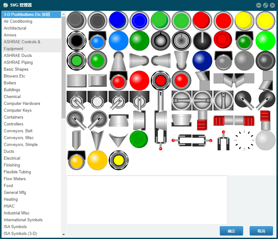
此控制元件可用於顯示SVG圖形影象。
- SVG 指可伸縮向量圖形 (Scalable Vector Graphics)
- SVG 用來定義用於網路的基於向量的圖形
- SVG 使用 XML 格式定義圖形
- SVG 影象在放大或改變尺寸的情況下其圖形質量不會有所損失
- SVG 是萬維網聯盟的標準
- SVG 與諸如 DOM 和 XSL 之類的 W3C 標準是一個整體
關於SVG的定義及使用的方法請參考MDN SVG文件 (opens new window)。
雙擊可以打開SVG瀏覽器,選擇進行瀏覽。
# 1.1. 屬性
| 屬性 | 說明 |
|---|---|
| HTML | 設定SVG圖形顯示的定義,在此處輸入SVG圖形的內容 |
| Interval | 設定SVG圖形變換的時間間隔,以ms為單位 |
| SVGImgList | 設定SVG圖形列表控制元件的名稱,如此處為空,則預設顯示HTML中的內容 |
| ThreadEnabled | 是否啟用定時器執行緒,如SVGImgList處未指定,則此項可設定為自旋轉 |
# 2. TUgSVGImgList
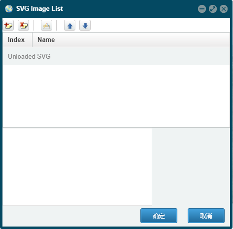
此控制元件用於儲存SVG顯示的系列,雙擊可打開管理器管理顯示的SVG圖形。
# 3. TUgAppAppLeafLetMap
此控制元件為專業的互動式地圖顯示控制元件。
# 3.1. 屬性
# 3.1.1. MapOptions
property MapOptions: TMapOptions;
設定地圖相關的設定選項。
# 3.1.1.1. AnimationOptions
property AnimationOptions: TAnimationOptions;
動畫效果的相關設定專案。這些設定專案僅在地圖首次初始化前可設定,初始化后的修改不生效。
| 屬性名稱 | 型別 | 說明 |
|---|---|---|
| fadeAnimation | Boolean | 是否啟用淡出淡出動畫,預設為True。 |
| markerZoomAnimation | Boolean | Marker 標記是否使用縮放動畫進行縮放,預設為True。 |
| transform3DLimit | Integer | 定義了 CSS 轉換的最大尺寸。預設值為223,其取值不應發生變化。 |
| zoomAnimation | Boolean | 是否啟用地圖縮放動畫,預設為True。 |
| zoomAnimationThreshold | Integer | 如果縮放差異超過此值,則不會為縮放設定動畫,預設取值為4。 |
# 3.1.1.2. ControlOptions
property ControlOptions: TControlOptions;
控制的相關設定專案。這些設定專案僅在地圖首次初始化前可設定,初始化后的修改不生效。
| 屬性名稱 | 型別 | 說明 |
|---|---|---|
| attrubitionControl | Boolean | 預設情況下,是否將版權控制元件新增到地圖中。 |
| zoomControl | Boolean | 預設情況下,是否將縮放控制元件新增至地圖中。 |
# 3.1.1.3. fullscreenControl
property fullscreenControl: Boolean;
設定是否在地圖上新增全屏顯示的按鈕。此項僅在地圖首次初始化前可設定,初始化后的修改不生效。
# 3.1.1.4. InteractionOptions
property InteractionOptions: TInteractionOptions;
設定互動相關的選項。這些設定專案僅在地圖首次初始化前可設定,初始化后的修改不生效。
| 屬性名稱 | 型別 | 說明 |
|---|---|---|
| boxZoom | Boolean | 是否可以在按住 shift 鍵的同時拖動滑鼠將地圖縮放到指定的矩形區域。 |
| closePopupOnClick | Boolean | 如果不希望使用者點選地圖時彈出視窗自動關閉,則可以將其設定為 false。 |
| doubleClickZoom | String | 地圖是否可以通過雙擊來放大,以及在按住 shift 的同時雙擊來縮小。如果設定為 'center',不管滑鼠在哪裡,雙擊縮放都將縮放到檢視的中心。 |
| dragging | Boolean | 地圖是否可以通過 滑鼠/觸控式螢幕 進行拖動。 |
| zoomDelta | Double | 控制元件在進行縮放的操作時地圖縮放的級別改變的數值大小,設定為小於1的數值可以允許縮放更精細化與顆粒化 |
| zoomSnap | Integer | 強制設定地圖的縮放級別為這個值的倍數,預設情況下,縮放級別將是其最接近的整數; 數值為0意味著不進行強制設定 |
# 3.1.1.5. KeyboardNavigationOptions
property KeyboardNavigationOptions: TKeyboardNavigationOptions;
設定鍵盤導航設定的相關選項。這些設定專案僅在地圖首次初始化前可設定,初始化后的修改不生效。
| 屬性名稱 | 型別 | 說明 |
|---|---|---|
| keyboard | Boolean | 地圖是否獲得焦點,並且允許使用者通過鍵盤和 +/- 來進行瀏覽地圖。 |
| keyboardPanDelta | Integer | 按下方向鍵時,地圖平移的畫素數量。 |
# 3.1.1.6. MapStateOptions
property MapStateOptions: TMapStateOptions;
設定地圖狀態的相關選項。這些設定專案僅在地圖首次初始化前可設定,初始化后的修改不生效。
| 屬性名稱 | 型別 | 說明 |
|---|---|---|
| center | string | 地圖初始化時的中心點位置,以陣列的形式來表示[30,120] |
| crs | string | 該地圖使用的座標系。如果你不確定此處表示的座標系是什麼意思,請不要更改它。 |
| maxBounds | string | 當這個選項被設定后,地圖將被限制在指定的地理邊界內, 當用戶平移將地圖拖動到檢視以外的範圍時會出現彈回的效果, 並且也不允許縮小檢視到指定範圍以外的區域(這取決於地圖的尺寸) |
| maxZoom | Integer | 地圖的最大縮放級別。 |
| minZoom | Integer | 地圖的最小縮放級別。 |
| renderer | string | 在地圖上繪製向量圖層的預設方法,預設為 L.SVG 或 L.Canvas, 這取決於瀏覽器是否支援。 |
| zoom | Integer | 設定地圖初始化時的縮放等級。 |
# 3.1.1.7. MouseWheelOptions
property MouseWheelOptions: TMouseWheelOptions;
設定地圖滑鼠滾輪操作的相關選項。這些設定專案僅在地圖首次初始化前可設定,初始化后的修改不生效。
| 屬性名稱 | 型別 | 說明 |
|---|---|---|
| scrollWheelZoom | string | 地圖是否允許通過使用滑鼠滾輪進行縮放。如果設定為'center',不管滑鼠在哪裡,都將會放大到檢視的中心。 |
| wheelDebounceTime | Integer | 限制滾輪的觸發速度(以毫秒為單位)。預設情況下,使用者通過滾輪縮放的次數間隔不能小於 40 毫秒。 |
| wheelPxPerZoomLevel | Integer | 多少滾動畫素意味著一個完整縮放級別的更改。 較小的值將使滾輪變焦更快(反之亦然)。 |
# 3.1.1.8. PanningInertiaOptions
property PanningInertiaOptions: TPanningInertiaOptions;
設定在修改地圖中心的方法中使用到的相關選項。這些設定專案僅在地圖首次初始化前可設定,初始化后的修改不生效。
| 屬性名稱 | 型別 | 說明 |
|---|---|---|
| easeLinearity | Double | 平移動畫緩動的曲率因子(三次貝塞爾曲線的一個參數)。1.0 表示線性動畫,這個數字越小,曲線越彎曲。 |
| inertia | Boolean | 如果啟用,地圖的平移會有一種慣性效應,即地圖在拖動時形成動力,並在一段時間內繼續向同一方向移動。此項設定可提高在觸控式螢幕設備上的使用體驗。預設情況下是啟用的。 |
| inertiaDeceleration | Integer | 慣性運動減速的速度,以畫素/秒為單位。 |
| inertiaMaxSpeed | Integer | 慣性運動的最大速度,以畫素/秒為單位。 |
| maxBoundsViscosity | Integer | 如果設定了 maxBounds,這個選項將控制拖動地圖時邊界的穩固程度。預設值為 0.0,允許使用者以正常速度在界外拖動,更高的值會減慢地圖在界外的拖動速度,而 1.0 使界外完全穩固,防止使用者在界外拖動。 |
| worldCopyJump | Boolean | 啟用該選項后,當你平移到世界的另一個 "copy" 時,地圖會跟蹤並無縫跳轉到原來的副本,這樣所有的覆蓋物如 markers(標記)和 vector layers(向量圖層)都仍然可見。 |
# 3.1.1.9. preferCanvas
property preferCanvas: Boolean;
是否使用 Canvas 來渲染 Path(路徑)。預設情況下,所有 Path 都是使用 SVG 進行渲染。
# 3.1.1.10. TouchInterationOptions
property TouchInterationOptions: TTouchInterationOptions;
設定地圖觸控互動的相關選項。這些設定專案僅在地圖首次初始化前可設定,初始化后的修改不生效。
| 屬性名稱 | 型別 | 說明 |
|---|---|---|
| bounceAtZoomLimits | Boolean | 如果您不希望在地圖縮放超過最小/最大縮放範圍時反彈,請將其設定為 false。 |
| tap | Boolean | 是否啟用 mobile hacks 以支援 taps(在 iOS / Android上 修復 200ms 點選延遲)和 touch(觸發 contextmenu 事件)。 |
| taptolerance | Integer | 使用者在觸控時,移動手指的畫素數超過此值時被認為是有效的 tap。 |
| touchZoom | string | 地圖是否允許通過兩根手指的觸控拖動進行縮放。如果通過 'center',就會放大到檢視的中心,而不管 touch 事件(手指)在哪裡。對具有 touch-capable 功能的網路瀏覽器來說是啟用的。 |
# 3.2. 事件
| 事件名稱 | 觸發條件 |
|---|---|
| OnMarkerClick | 當點選地圖中的標記時觸發事件 |
| OnMapClick | 當點選地圖上的內容時觸發事件 |
| OnMapLocation | 當地圖定位時觸發事件 |
| OnCurrentPosition | 設定目前定位時觸發事件 |
# 3.3. 方法
# 3.3.1. InitMap
procedure InitMap;
呼叫此方法后,地圖控制元件將初始化。
# 3.3.2. GetCenter
procedure GetCenter;
獲取
# 3.3.3. GetCurrentPosition
procedure GetCurrentPosition;
獲取目前地圖的定位資訊。
# 3.3.4. PrintMap
procedure PrintMap;
呼叫地圖的列印功能。
# 3.3.5. AddNavBar
procedure AddNavBar;
在地圖中新增導航欄的元件。
# 3.3.6. AddScale
procedure AddScale;
在地圖中新增比例尺的元件。
# 3.3.7. SetView
procedure SetView(Lat: string; Lng: string; maxZoom: Integer; Options: string);
用指定的動畫選項來設定地圖的檢視。
//JScript
//將地圖的中心定位至指定的經緯度,並調整其縮放級別。
UgAppLeafLetMap01.setView("39.924317","116.390619",13);
2
3
//PasScript
//將地圖的中心定位至指定的經緯度,並調整其縮放級別。
UgAppLeafLetMap01.setView('39.924317','116.390619',13);
2
3
// Make sure to add code blocks to your code group
# 3.3.8. SetZoom
procedure SetZoom(Zoom: Integer; Options: string);
設定地圖的縮放級別。
//JScript
//設定放大級別
UgAppLeafLetMap01.SetZoom(18);
2
3
//PasScript
//設定放大級別
UgAppLeafLetMap01.SetZoom(18);
2
3
// Make sure to add code blocks to your code group
# 3.3.9. ZoomIn
procedure ZoomIn(Zoom: Integer; Options: string);
設定放大地圖級別的數量。
//JScript
//放大
UgAppLeafLetMap01.ZoomIn(1);
2
3
//PasScript
//放大
UgAppLeafLetMap01.ZoomIn(1);
2
3
// Make sure to add code blocks to your code group
# 3.3.10. ZoomOut
procedure ZoomOut(Zoom: Integer; Options: string);
設定縮小地圖級別的數量。
//JScript
//縮少
UgAppLeafLetMap01.ZoomOut(1);
2
3
//PasScript
//縮少
UgAppLeafLetMap01.ZoomOut(1);
2
3
// Make sure to add code blocks to your code group
# 3.3.11. SetZoomAround
procedure SetZoomAround(Lat: string; Lng: string; Zoom: Integer; Options: string)
設定縮放地圖,同時保持地圖上的指定地理位置不變(功能類似於滾動縮放和雙擊縮放操作)。
# 3.3.12. FitBounds
procedure FitBounds(LatLngBounds: string; Options: string);
將地圖的檢視設定在給定的矩形地理範圍內,地圖會自動計算最大縮放級別和中心點。
# 3.3.13. FitWorld
procedure FitWorld(Options: string);
設定一個包含整個世界的地圖檢視,其縮放級別為最大。
# 3.3.14. PanTo
procedure PanTo(Lat: string; Lng: string; Options: string);
將地圖平移到一個指定的中心點。
# 3.3.15. SetMinZoom
procedure SetMinZoom(zoom: Integer);
設定地圖的最小縮放級別。
# 3.3.16. SetMaxZoom
procedure SetMaxZoom(zoom: Integer);
設定地圖的最大縮放級別。
# 3.3.17. Locate
procedure Locate(setView: Boolean; maxZomm: Integer; watch: Boolean; timeout: Integer; maximumAge: Integer; enableHighAccuracy: Boolean);
獲取目前設備的定位資訊,此方法要求瀏覽器訪問的網站運行在https模式下。
| 選項 | 型別 | 預設 | 說明 |
|---|---|---|---|
| watch | Boolean | false | 如果為 true,則開始使用 W3C watchPosition 方法連續觀察位置變化(而不是檢測一次)。之後你可以使用 StopLocate 方法停止觀察。 |
| setView | Boolean | false | 如果為 true,則根據檢測精度自動將地圖檢視設定為使用者位置,如果地理定位失敗,則自動設定為世界檢視。 |
| maxZoom | Integer | Infinity | 使用 setView 選項時,自動檢視設定的最大縮放。 |
| timeout | Integer | 10000 | 在觸發 locationerror 事件之前等待來自地理位置響應的毫秒數 。 |
| maximumAge | Integer | 0 | 檢測到的位置的最大時長。如果自上次地理定位響應以來經過的毫秒數少於此毫秒數,locate 則將返回快取的位置。 |
| enableHighAccuracy | Boolean | false | 啟用高精度 |
# 3.3.18. StopLocate
procedure StopLocate;
使用此方法后,停止定位。
# 3.3.19. AddTileLayer
procedure AddTilelayer(value: TTileLayer);
使用此方法可在地圖上載入瓦片圖層。
//JScript
  var TileLayer,TileLayer1;
  //建立圖層配置
  TileLayer= new TTileLayer();
  TileLayer.Id = "1";
  TileLayer.tileLayer = "https://tile.openstreetmap.org/{z}/{x}/{y}.png";
  TileLayer.minZoom = 1;
  TileLayer.maxZoom = 18;
  TileLayer.noWrap = true;
  //建立瓦片圖層
  UgAppLeafLetMap01.AddTilelayer(TileLayer);

  //建立圖層配置
  TileLayer1= new TTileLayer();
  TileLayer1.Id = "2";
  TileLayer1.tileLayer = "https://api.mapbox.com/styles/v1/mapbox/satellite-v9/tiles/{z}/{x}/{y}?access_token={TOKEN}";
  TileLayer1.minZoom = 1;
  TileLayer1.maxZoom = 18;
  TileLayer1.noWrap = true;
  //建立瓦片圖層
  UgAppLeafLetMap01.AddTilelayer(TileLayer1);
2
3
4
5
6
7
8
9
10
11
12
13
14
15
16
17
18
19
20
21
//PasScript
Var
  TileLayer,TileLayer1:TTileLayer;
begin
  //建立圖層配置
  TileLayer:=TTileLayer.Create;
  TileLayer.Id := '1';
  TileLayer.tileLayer := 'https://tile.openstreetmap.org/{z}/{x}/{y}.png';
  TileLayer.minZoom := 1;
  TileLayer.maxZoom := 18;
  TileLayer.noWrap := true;
  //建立瓦片圖層
  UgAppLeafLetMap01.AddTilelayer(TileLayer);

  //建立圖層配置
  TileLayer1:=TTileLayer.Create;
  TileLayer1.Id := '2';
  TileLayer1.tileLayer := 'https://api.mapbox.com/styles/v1/mapbox/satellite-v9/tiles/{z}/{x}/{y}?access_token={TOKEN}';
  TileLayer1.minZoom := 1;
  TileLayer1.maxZoom := 18;
  TileLayer1.noWrap := true;
  //建立瓦片圖層
  UgAppLeafLetMap01.AddTilelayer(TileLayer1);
end;
2
3
4
5
6
7
8
9
10
11
12
13
14
15
16
17
18
19
20
21
22
23
24
// Make sure to add code blocks to your code group
其中的瓦片圖層使用的URL地址為以下的格式:
'http://{s}.somedomain.com/blabla/{z}/{x}/{y}{r}.png'
{s} 是指可用的子域之一(按順序使用,以幫助解決每個域的瀏覽器並行請求限制;子域值在選項中指定;預設為 a, b 或 c , 可以省略), {z} — 縮放級別, {x} 和 {y} — 瓦片座標。 {r} 可以用來在URL中新增 "@2x" 以載入視網膜瓦片。
# 3.3.20. LayerGroupAddLayer
procedure LayerGroupAddLayer(Id: string)
將給定的圖層新增到組中。
//JScript
  UgAppLeafLetMap01.LayerGroupAddLayer("1");
  UgAppLeafLetMap01.LayerGroupAddLayer("2");
  UgAppLeafLetMap01.MapAddLayerGroup;
  UgAppLeafLetMap01.MapAddControlLayers;
2
3
4
5
//PasScript
begin
  UgAppLeafLetMap01.LayerGroupAddLayer('1');
  UgAppLeafLetMap01.LayerGroupAddLayer('2');
  UgAppLeafLetMap01.MapAddLayerGroup;
  UgAppLeafLetMap01.MapAddControlLayers;
end;
2
3
4
5
6
7
// Make sure to add code blocks to your code group
# 3.3.21. FeatureGroupAddLayer
procedure FeatureGroupAddLayer(Id: string);
將給定的圖層新增至要素組中。
# 3.3.22. MapAddTileLayer
procedure MapAddTilelayer(Id: string);
為地圖新增給定的瓦片圖層。
# 3.3.23. MapAddLayerGroup
procedure MapAddLayerGroup;
為地圖新增特定的組。
# 3.3.24. MapAddFeatureGroup
procedure MapAddFeatureGroup;
為地圖新增特定的要素組。
# 3.3.25. MapAddControlLayers
procedure MapAddControlLayers;
為地圖新增控制層。
# 3.3.26. SpeedUp
procedure SpeedUp;
加快標記的移動速度。
# 3.3.27. SpeedDown
procedure SpeedDown;
減慢標記的移動速度。
# 3.3.28. Start
procedure Start;
設定開始移動標記。
# 3.3.29. Pause
procedure Pause;
設定暫停移動標記。
# 3.3.30. Stop
procedure Stop;
設定停止移動標記。
# 3.3.31. AddMarker
procedure AddMarker(value: TMarker);
在地圖上新增一個標記。
//JScript
 var Marker,Icon;
 //建立圖示
 Icon = new TBaseIcon();
 Icon.IconUrl = "files/car_red.png";
 //建立Marker
 Marker = TMarker;
 Marker.Id = "2";
 Marker.Keyboard = true;
 Marker.Title = "";
 Marker.Alt = " ";
 Marker.Lat = "30.675048";
 Marker.Lng = "120.604017";
 Marker.Icon = Icon.ToString;
 UgAppLeafLetMap01.AddMarker(Marker);
2
3
4
5
6
7
8
9
10
11
12
13
14
15
//PasScript
Var
 Marker:TMarker;
 Icon:TBaseIcon;
begin
 //建立圖示
 Icon:= TBaseIcon.Create;
 Icon.IconUrl := 'files/car_red.png';
 //建立Marker
 Marker := TMarker.Create;
 Marker.Id := '2';
 Marker.Keyboard := true;
 Marker.Title := '';
 Marker.Alt := ' ';
 Marker.Lat := '30.675048';
 Marker.Lng := '120.604017';
 Marker.Icon := Icon.ToString;
 UgAppLeafLetMap01.AddMarker(Marker);
end;
2
3
4
5
6
7
8
9
10
11
12
13
14
15
16
17
18
19
// Make sure to add code blocks to your code group
# 3.3.32. DeleteAllMarker
procedure DeleteAllMarker;
刪除地圖上所有的標記資訊。
# 3.3.33. DeleteMarker
procedure DeleteMarker(Id: string);
刪除指定的地圖示記。
# 3.3.34. SetMarkerPosition
procedure SetMarkerPosition(Id: string; Lat: string; Lng: string);
設定指定的地圖示記指向的地理位置。
UgAppLeafLetMap01.SetMarkerPosition('1','30.675048','120.604017');
# 3.3.35. SetMarkerPopupContent
procedure SetMarkerPopupContent(Id: string; Content: string);
設定地圖示記對應的彈出視窗中顯示的文字內容。
//JScript
 var Marker,Circle;
 Marker = new TMarker();
 Marker.Id = "location";
 Marker.Lat = lat;
 Marker.Lng = lng;
 UgAppLeafLetMap01.AddMarker(Marker);

 Circle= new TCircle();
 Circle.Id = "location";
 Circle.LatLngs = "["+lat+","+lng+"]";
 Circle.Radius = trunc(StrToFloat(radius));
 UgAppLeafLetMap01.AddCircle(circle);
 UgAppLeafLetMap01.SetMarkerPopupContent("location","You are in " +radius+ " meters radius");
2
3
4
5
6
7
8
9
10
11
12
13
14
//PasScript
procedure UgAppLeafLetMap01OnMapLocation(sender: tobject;lat: string;lng: string;radius: string);
Var
 Marker:TMarker;
 Circle:TCircle;
begin
 Marker := TMarker.Create;
 Marker.Id := 'location';
 Marker.Lat := lat;
 Marker.Lng := lng;
 UgAppLeafLetMap01.AddMarker(Marker);

 Circle:=TCircle.Create;
 Circle.Id := 'location';
 Circle.LatLngs := '['+lat+','+lng+']';
 Circle.Radius := trunc(StrToFloat(radius));
 UgAppLeafLetMap01.AddCircle(circle);
 UgAppLeafLetMap01.SetMarkerPopupContent('location','You are in ' +radius+ ' meters radius');
end;
2
3
4
5
6
7
8
9
10
11
12
13
14
15
16
17
18
19
// Make sure to add code blocks to your code group
# 3.3.36. SetMarkerTooltipContent
procedure SetMarkerTooltipContent(Id: string; Content: string);
設定與地圖示記繫結的工具提示顯示的內容。
//JScript
UgAppLeafLetMap01.SetMarkerTooltipContent("1","I am here~~~");
2
//PasScript
UgAppLeafLetMap01.SetMarkerTooltipContent('1','I am here~~~');
2
// Make sure to add code blocks to your code group
# 3.3.37. AddPopup
procedure AddPopup(value: TPopup);
新增彈出對話方塊元件。
//JScript
  var Popup;
  Popup= new TPopup();
  Popup.Id = "1";
  Popup.Lat = "30.675048";
  Popup.Lng = "120.604017";
  Popup.Content = "<p>I am the First Popup<p>This is the Second</br>";
  UgAppLeafLetMap01.AddPopup(Popup);
2
3
4
5
6
7
8
//PasScript
Var
 Popup:TPopup;
begin
  Popup:=TPopup.Create;
  Popup.Id := '1';
  Popup.Lat := '30.675048';
  Popup.Lng := '120.604017';
  Popup.Content := '<p>I am the First Popup<p>This is the Second</br>';
  UgAppLeafLetMap01.AddPopup(Popup);
end;
2
3
4
5
6
7
8
9
10
11
// Make sure to add code blocks to your code group
# 3.3.38. DeleteAllPopup
procedure DeleteAllPopup;
刪除所有的彈出對話方塊元件。
# 3.3.39. DeletePopup
procedure DeletePopup(Id: string);
刪除指定的對話方塊元件。
# 3.3.40. SetPopupPosition
procedure SetPopupPosition(Id: string; Lat: string; Lng: string);
設定繫結的彈出對話方塊元件顯示的經緯度位置。
# 3.3.41. SetPopupContent
procedure SetPopupContent(Id: string; Content: string);
設定繫結的彈出對話方塊元件顯示的文字內容。
# 3.3.42. AddPolyline
procedure AddPolyline(value: TPolyline);
在地圖中新增折線。
//JScript
  var Polyline;
  Polyline= new TPolyline();
  Polyline.Id = "1";
  Polyline.LatLngs = "[[31.51, 120.68],[32.77, 122.43]]";
  Polyline.Color = "green";
  UgAppLeafLetMap01.AddPolyline(Polyline);
2
3
4
5
6
7
//PasScript
Var
  Polyline:TPolyline;
begin
  Polyline:=TPolyline.Create;
  Polyline.Id := '1';
  Polyline.LatLngs := '[[31.51, 120.68],[32.77, 122.43]]';
  Polyline.Color := 'green';
  UgAppLeafLetMap01.AddPolyline(Polyline);
end;
2
3
4
5
6
7
8
9
10
// Make sure to add code blocks to your code group
# 3.3.43. DeleteAllPolyline
procedure DeleteAllPolyline;
刪除所有的折線。
# 3.3.44. DeletePolyline
procedure DeletePolyline(Id: string);
刪除指定的折線。
# 3.3.45. AddPolylineLatLng
procedure AddPolylineLatLng(Id: string; LatLng: string);
為指定的折線圖形根據目標經緯度的座標點新增折線。
# 3.3.46. AddPolygon
procedure AddPolygon(value: TPolygon);
在地圖中新增一個多邊形。
//JScript
  var Polygon;
  Polygon= new TPolygon();
  Polygon.Id = "1";
  Polygon.LatLngs = "[[30.51, 120.68],[37.77, 122.43],[34.04, 118.2]]";
  Polygon.Color = "red";
  UgAppLeafLetMap01.AddPolygon(Polygon);
2
3
4
5
6
7
//PasScript
Var
  Polygon:TPolygon;
begin
  Polygon:=TPolygon.Create;
  Polygon.Id := '1';
  Polygon.LatLngs := '[[30.51, 120.68],[37.77, 122.43],[34.04, 118.2]]';
  Polygon.Color := 'red';
  UgAppLeafLetMap01.AddPolygon(Polygon);
end;
2
3
4
5
6
7
8
9
10
// Make sure to add code blocks to your code group
# 3.3.47. DeleteAllPolygon
procedure DeleteAllPolygon;
刪除地圖上所有的多邊形。
# 3.3.48. DeletePolygon
procedure DeletePolygon(Id: string);
刪除地圖上指定的多邊形。
# 3.3.49. AddPolygonLatLng
procedure AddPolygonLatLng(Id: string; LatLng: string);
為指定的多邊形根據目標經緯度的座標點新增折線。
# 3.3.50. AddRectangle
procedure AddRectangle(value: TRectangle);
為地圖新增矩形。
//JScript
  var Rectangle;
  Rectangle= new TRectangle();
  Rectangle.Id = "1";
  //給定矩形指定的邊界,合圍的區域就是矩形
  Rectangle.LatLngs = "[[54.559322, -5.767822], [56.1210604, -3.021240]]";
  Rectangle.Color = "red";
  Rectangle.Weight = 1;
  UgAppLeafLetMap01.AddRectangle(Rectangle);
2
3
4
5
6
7
8
9
//PasScript
Var
  Rectangle:TRectangle;
begin
  Rectangle:=TRectangle.Create;
  Rectangle.Id := '1';
  //給定矩形指定的邊界,合圍的區域就是矩形
  Rectangle.LatLngs := '[[54.559322, -5.767822], [56.1210604, -3.021240]]';
  Rectangle.Color := 'red';
  Rectangle.Weight := 1;
  UgAppLeafLetMap01.AddRectangle(Rectangle);
end;
2
3
4
5
6
7
8
9
10
11
12
// Make sure to add code blocks to your code group
# 3.3.51. DeleteAllRectangle
procedure DeleteAllRectangle;
刪除所有的矩形。
# 3.3.52. DeleteRectangle
procedure DeleteRectangle(Id: string);
刪除矩形。
# 3.3.53. AddRectangleLatLng
procedure AddRectangleLatLng(Id: string; LatLng: string)
根據給定的經緯度位置新增一個邊。
# 3.3.54. AddCircle
procedure AddCircle(value: TCircle);
新增一個圓形。
//JScript
  var Circle;
  Circle= new TCircle();
  Circle.Id = "1";
  //圓中心點的位置
  Circle.LatLngs = "[30.675048,120.604017]";
  //圓的半徑,以米為單位
  Circle.Radius = 200;
  UgAppLeafLetMap01.AddCircle(Circle);
2
3
4
5
6
7
8
9
//PasScript
Var
  Circle:TCircle;
begin
  Circle:=TCircle.Create;
  Circle.Id := '1';
  //圓中心點的位置
  Circle.LatLngs := '[30.675048,120.604017]';
  //圓的半徑,以米為單位
  Circle.Radius := 200;
  UgAppLeafLetMap01.AddCircle(Circle);
end;
2
3
4
5
6
7
8
9
10
11
12
// Make sure to add code blocks to your code group
# 3.3.55. DeleteAllCircle
procedure DeleteAllCircle;
刪除所有的圓。
# 3.3.56. DeleteCircle
procedure DeleteCircle(Id: string);
刪除指定的圓。
# 3.3.57. SetCirclePosition
procedure SetCirclePosition(Id: string; Lat: string; Lng: string)
重新設定繫結的圓形的位置。
# 3.3.58. SetCircleRadius
procedure SetCircleRadius(Id: string; Radius: Integer);
重新設定指定的圓的半徑。
# 3.3.59. AddCircleMarker
procedure AddCircleMarker(value: TCircleMarker);
新增一個帶圓中心點的標記。
//JScript
  var CircleMarker;
  CircleMarker= new TCircleMarker();
  CircleMarker.Id = "1";
  CircleMarker.LatLngs = "[30.675048,120.604017]";
  CircleMarker.Radius = 200;
  UgAppLeafLetMap01.AddCircleMarker(CircleMarker);
2
3
4
5
6
7
//PasScript
Var
  CircleMarker:TCircleMarker;
begin
  CircleMarker:=TCircleMarker.Create;
  CircleMarker.Id := '1';
  CircleMarker.LatLngs := '[30.675048,120.604017]';
  CircleMarker.Radius := 200;
  UgAppLeafLetMap01.AddCircleMarker(CircleMarker);
end;
2
3
4
5
6
7
8
9
10
// Make sure to add code blocks to your code group
# 3.3.60. DeleteAllCircleMarker
procedure DeleteAllCircleMarker;
刪除所有的帶標記的圓。
# 3.3.61. SetCircleMarkerPosition
procedure SetCircleMarkerPosition(Id: string; Lat: string; Lng: string)
重新設定標記圓標定的位置。
# 3.3.62. SetCircleMarkerRadius
procedure SetCircleMarkerRadius(Id: string; Radius: Integer)
重新設定標記圓標定的半徑。
# 3.3.63. AddImageOverlay
procedure AddImageOverlay(value: TImageOverlay);
新增圖片的圖層。
//JScript
  var ImageOverlay;
  ImageOverlay= new TImageOverlay();
  ImageOverlay.Id = "1";
  ImageOverlay.Url = "files/car_red.png";
  ImageOverlay.Bounds = "[[ 30, 120], [ 31.5, 121.88]]";
  UgAppLeafLetMap01.AddImageOverlay(ImageOverlay);
  UgAppLeafLetMap01.setZoom(8);
2
3
4
5
6
7
8
//PasScript
Var
 ImageOverlay:TImageOverlay;
begin
    ImageOverlay:=TImageOverlay.Create;
    ImageOverlay.Id := '1';
    ImageOverlay.Url := 'files/car_red.png';
    ImageOverlay.Bounds := '[[ 30, 120], [ 31.5, 121.88]]';
    UgAppLeafLetMap01.AddImageOverlay(ImageOverlay);
    UgAppLeafLetMap01.setZoom(8);
end;
2
3
4
5
6
7
8
9
10
11
// Make sure to add code blocks to your code group
# 3.3.64. DeleteAllImageOverlay
procedure DeleteAllImageOverlay;
刪除所有的圖片圖層。
# 3.3.65. DeleteImageOverlay
procedure DeleteImageOverlay(Id: string);
刪除指定的圖片圖層。
# 3.3.66. SetImageOverlayBounds
procedure SetImageOverlayBounds(Id: string; LatLng: string)
設定圖片圖層顯示的邊界。
# 3.3.67. AddVideoOverlay
procedure AddVideoOverlay(value: TVideoOverlay);
新增視訊的圖層。
//JScript
  var videoOverlay;
  videoOverlay= new TVideoOverlay();
  videoOverlay.Id = "1";
  videoOverlay.Url = "https://vod.300hu.com/4c1f7a6atransbjngwcloud1oss/6ceb8e64340179614968700929/v.f30.mp4";
  videoOverlay.Bounds = "[[ 30, 120], [ 31.5, 121.88]]";
  UgAppLeafLetMap01.AddVideoOverlay(videoOverlay);
  UgAppLeafLetMap01.setZoom(8);
2
3
4
5
6
7
8
//PasScript
Var
 videoOverlay:TVideoOverlay;
begin
    videoOverlay:=TVideoOverlay.Create;
    videoOverlay.Id := '1';
    videoOverlay.Url := 'https://vod.300hu.com/4c1f7a6atransbjngwcloud1oss/6ceb8e64340179614968700929/v.f30.mp4';
    videoOverlay.Bounds := '[[ 30, 120], [ 31.5, 121.88]]';
    UgAppLeafLetMap01.AddVideoOverlay(videoOverlay);
    UgAppLeafLetMap01.setZoom(8);
end;
2
3
4
5
6
7
8
9
10
11
// Make sure to add code blocks to your code group
# 3.3.68. DeleteAllVideoOverlay
procedure DeleteAllVideoOverlay;
刪除所有的視訊圖層。
# 3.3.69. DeleteVideoOverlay
procedure DeleteVideoOverlay(Id: string);
刪除指定的視訊圖層。
# 3.3.70. SetVideoOverlayBounds
procedure SetVideoOverlayBounds(Id: string; LatLng: string);
設定視訊圖層的邊界。